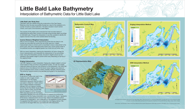
Little Bald Lake bathymetry maps investigating the differences between Inverse Distance Weighted and Kriging methods for interpolating bathymetric contours. Interpolations done using ESRI ArcGIS, maps created using ArcGIS and Adobe Illustrator.